Dorchester Illustration no. 2435 Neponset Playground/Garvey Playground
In October, a groundbreaking ceremony was held for a $5.1 million renovation to Garvey Playground. If you drive by the playground now, you will see lots of big trucks and shovels and other heavy equipment along with piles and piles of fill. See Dorchester Reporter https://www.dotnews.com/2019/51m-rehab-project-begins-garvey-park
Mayor Walsh mentioned that the drainage plans for a new system to prevent flooding in the surrounding neighborhood will help the city with response to the effects of climate change. This statement made me wonder why the playground would present a problem with flooding.
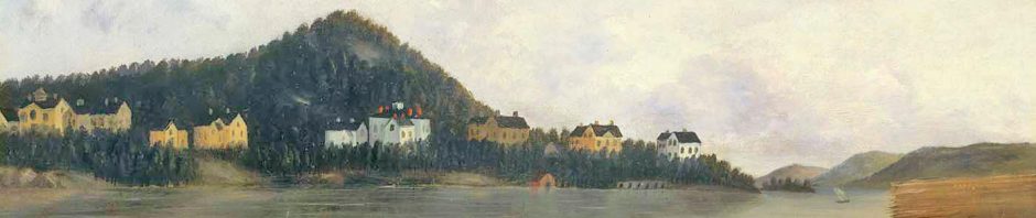
In the late 1890s, the City acquired the property for Neponset Playground and began to make improvements with new drainage and fill. The property was described in the 1898 Annual Report of the Park Department of the City of Boston as “containing eighteen acres of salt marsh, lying between Neponset Avenue and the Old Colony Railroad. A dam with a tidal gate has been built to keep out the tide-water, and, by the construction of an open ditch on the northerly border of the field, the laying of tile drains, and the filling of the creeks and ditches, will make the ground available for temporary use as a playground, until it can be filled and properly surfaced.”
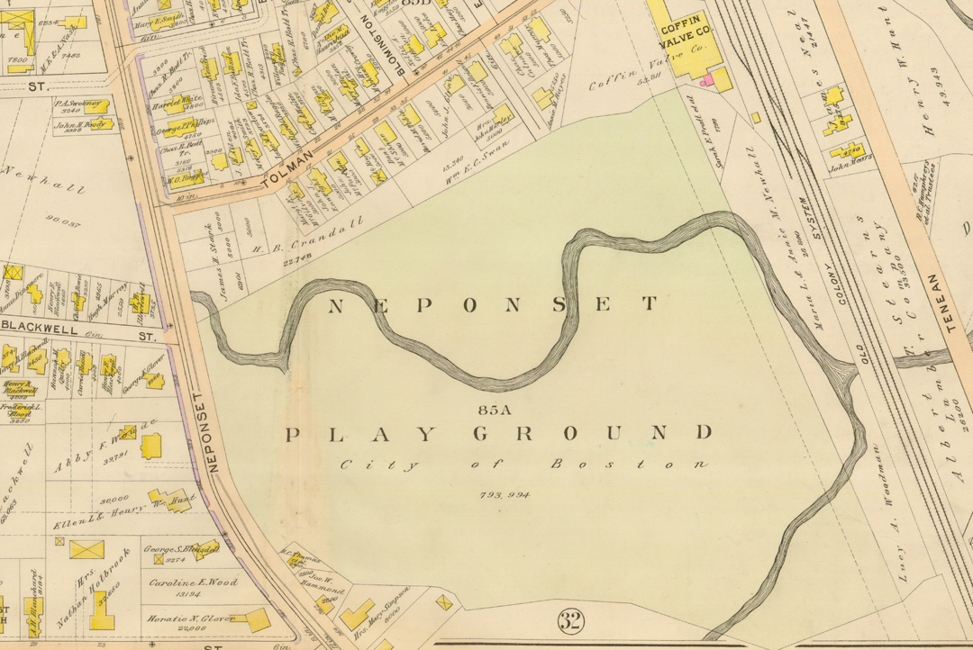
The map shows the playgound as represented in the 1898 atlas of Dorchester. There are two branches of streams that join to form one stream leading out to Pine Brook Creek past Tenean Beach to the mouth of the Neponset River. The tidal flow into the Neponset River combined with the runoff of the streams made the ground marshy until the property was drained by the Park Department. With rising sea level and higher tides, the flow could have consequences unforeseen a century ago. Yesterday’s rain and tide brought water over Morrissey Boulevard, and some water probably found its way toward Garvey Park.
The 18 acres that comprised the playground in 1898 were reduced to about 14 acres when the Old Colony Parkway was constructed in the 19 teens and twenties. The construction of the Southeast Expressway took away about another 8 acres, leaving Garvey Park with under six acres today.
In older maps the northern branch of the stream angles off under Neponset Avenue toward the fire station and disappears at about Newhall Street. The southern branch had its origin about where the middle of Neponset Circle is located today.
The Dorchester Reporter says the park for was named for William H. Garvey, a Purple Heart and World War I Victory Medal recipient, lost his life on the last day of the Great War.